Los Angeles to Santa Barbara: Three Good Stops on the Coastal Drive
Leaving from somewhere else? Change the start and see your stops right now — your first trip is free, no signup.
About 95 miles from downtown Los Angeles to Santa Barbara via US‑101 — mostly coastal freeway and surf towns. Here is where we get out: a promontory with dramatic ocean views in Malibu, a low-key surfing promenade and pier in Ventura, and a broad, family-friendly state beach just before the city.
- ~95 miles · coastal freeway
- About 2 hr driving without heavy traffic
- US‑101 N / Pacific Coast corridor
- Beaches, surf breaks, seaside towns
This is one of the most straightforward coastal drives in California: out of Los Angeles you climb onto US‑101 and follow the shore north through beach cities, bluffs and wide ocean views. For many people Santa Barbara is the reward — a compact downtown, a Spanish‑mission church, and an easy harbor — but the three stops below are the ones that break up the highway and give the route a pace worth remembering. If you want fewer stops and more scenery, skip straight up the 101 and time it for early morning or evening light.
The distance and the basic routing are short and simple: Santa Barbara sits under 100 miles northwest of downtown Los Angeles on US‑101, the coastal freeway that links the two cities and the beach towns between them.
Stop 1 — Point Dume and Westward Beach, Malibu
Mile 30 · about 10 to 15 minutes off US‑101 via Pacific Coast Highway · 45 minutes to 1 hour
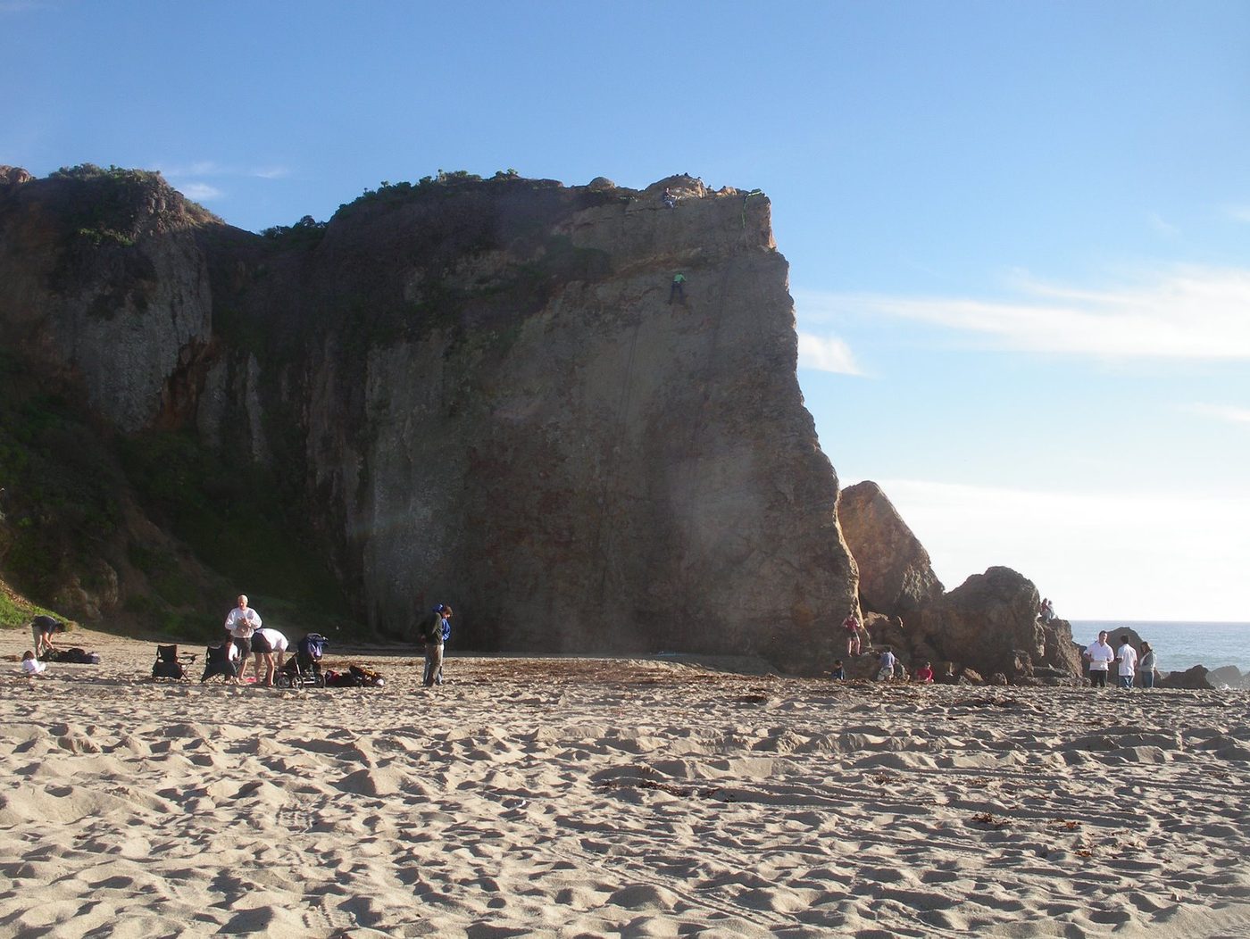
Here is where we get out for the first real view. Point Dume is the low promontory that juts into the Pacific above Malibu — head to the bluff parking and a short, mostly flat walk puts you on headland overlooks with long views back to Santa Monica and out to the Channel Islands. The trail along the bluff is short, the rock outcrops are dramatic, and it’s the place to stop if you want a proper ocean panorama without a long hike. The beach below is wide and sandy; if you want to stretch your legs, a walk down to Westward or Zuma is an option but expect extra time for parking.
If you need specifics: Point Dume is roughly thirty miles from central Los Angeles and functions as our natural first pause—coffee, a quick picnic, and the photo that makes the rest of the drive feel like an interlude. Allow 45 minutes if you just want the overlook; an hour if you walk down to the beach and poke around the tidepools when the tide is low.
If you have an extra 2 hours: Drive a few minutes down the Pacific Coast Highway to the Getty Villa for its small collection and gardens (parking and admission apply), or spend more time on Zuma Beach, which is one of the larger, more reliable stretch‑out beaches on the coast.
Stop 2 — Ventura Pier, Promenade and Surfers' Point
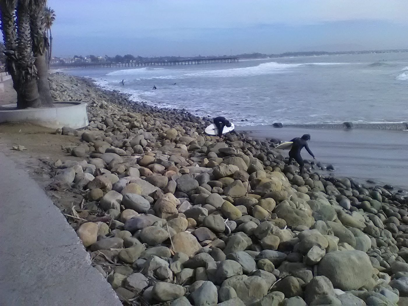
Mile 65 · about 5 minutes off US‑101 · 45 minutes to 1 hour
The Ventura waterfront is laid‑back in a way that feels Californian in the best sense: a working harbor, a classic wooden pier, a long promenade and a point break that draws surfers from across the region. Pull into downtown Ventura for bakery coffee and a short walk along Main or head straight to Surfers' Point at Seaside Park where the promenade and Omer Rains Bike Trail run next to the sand. That stretch is flat and easy, and it’s precisely the sort of place that undoes road tension: you can watch the surfers, look across the harbor to the boats, and decide whether to linger for lunch at one of the quieter seafood spots near the pier.
Ventura is also the logical last place to top off gas and snacks before the quieter coastline to the north; the town is easy to navigate and has a good selection of takeout and sit‑down lunch options depending on how much time you want to spend ashore.
Tell us where you are leaving from, when, and who is in the car — dog, toddler, EV, six-hour limit — and we will name the stops that actually fit. Your first trip is free, no card.
Stop 3 — Carpinteria State Beach and the Bluffs
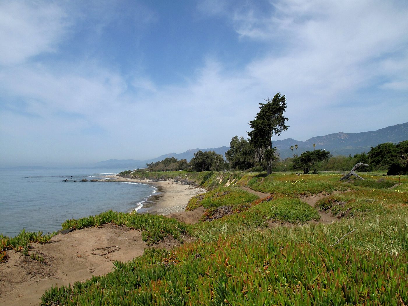
Mile 90 · about 2 minutes off US‑101 at the Palm Ave exit · 30 to 60 minutes
Carpinteria is small but unusually calm, and its state beach is one of the easiest, most family‑friendly beaches on the stretch into Santa Barbara. The sand is broad, the water is shallow near the shore, and there are boardwalks and lawns that make it a comfortable stop even for people traveling with kids or a dog. The Carpinteria Bluffs Nature Preserve above the beach is a short, scenic walk with coastal scrub and whale‑watching views in season; the salt marsh near the town is quiet and interesting for a five‑to‑ten minute nature stop.
Carpinteria sits just south of Santa Barbara, and the state beach is often the last wide coastal sand before you reach the city. It’s compact enough that a half hour will do if you just want the sand, and 45–60 minutes if you want a picnic and a short walk on the bluffs.
If you have an extra 2 hours: Turn inland for a short side trip to the Santa Ynez Valley wine country (Solvang and the winery roads are an hour or so northeast from the 101 at Buellton) — good if you’re making a longer day of it rather than an evening into Santa Barbara.
Arriving at Santa Barbara
Santa Barbara feels like the place that closes the loop on the drive: the mission sits near the hilltop, State Street runs from the waterfront into the downtown with restaurants and shops, and the harbor and Stearns Wharf make for a pleasant early evening stroll. Parking is more limited than the beaches, and the downtown blocks nearest the water can be crowded on summer weekends, so plan to arrive a little before sunset or after the late‑afternoon rush if you want a quieter first hour in town.
How we would time it
Leave Los Angeles early if you can: a 7:30 or 8:00 a.m. start gets you past the worst of inbound commute traffic and gives you morning light on the ocean. Stop at Point Dume for 45 minutes, resume and roll into Ventura around late morning for lunch and a walk (45–60 minutes), then finish with Carpinteria for a short beach break before rolling into Santa Barbara in the early evening. That timing keeps most of the driving in daylight and leaves time in Santa Barbara to check into a hotel and walk the waterfront.
Booking the rest of it
If you’re renting a car in Los Angeles for the one‑way or round trip, compare prices and policies before you book: one‑way fees, drop‑off locations and fuel policies change quickly. We usually compare EconomyBookings and GetRentacar for base prices and vehicle choice. For hotels, downtown Santa Barbara and the Funk Zone (the neighborhood east of State Street and the harbor) are the most convenient for walking; Carpinteria has modest motels if you want quieter, earlier access to the beach. If you’re visiting in summer, reserve rooms well in advance.
Why we put Carpinteria last
It’s the simplest beach stop closest to Santa Barbara: short walks, easy parking (relative to the city), and a feel that’s quietly local rather than touristy. If you want a longer beach day, Carpinteria is a better 90‑minute stop than trying to park in Santa Barbara right away; it lets you land in the city with less sand and more calm.
Notes on timing and traffic: the biggest variable on this drive is Los Angeles traffic in the morning and late afternoon, and the coastal 101 itself can slow significantly on summer weekends and holiday afternoons. If your schedule is tight and you want to avoid weekend congestion, plan to travel mid‑week or leave before 7 a.m. or after 7 p.m.; if you’re on a leisurely schedule, factor in an extra 60–90 minutes for stops and occasional bottlenecks north of Oxnard.
One more practical note: if you’re traveling with an electric vehicle, chargers become more frequent as you approach Ventura and Santa Barbara, but plan charging stops in Ventura or Carpinteria rather than relying on smaller towns between; if you’re on a tight fuel budget, Ventura is the sensible last major service town before Santa Barbara.
The three stops on a map
Stops in driving order. Map data © OpenStreetMap contributors.
How far is Los Angeles to Santa Barbara and how long does it take?
About 95 miles and roughly 2 hours of driving in light traffic via US‑101 north. Allow 2.5–3.5 hours (or more) during peak commute times and summer weekends.
What is the best route from Los Angeles to Santa Barbara?
US‑101 N along the coast is the usual choice for scenery and towns; you can use the I‑405 to shortcut parts of Los Angeles before joining the 101. Expect the coastal route to be slower in rush hours but far more scenic.
Where is the best place to stop for ocean views on the way?
Point Dume in Malibu is the top short stop for panoramic ocean views and easy bluff walks; Ventura’s Surfers' Point is best for people watching and relaxed seaside cafés, and Carpinteria is the easiest broad sand beach near Santa Barbara.
Are there good places to eat on the route?
Yes — Malibu has cafés and casual beachside options near Zuma and Point Dume, Ventura has solid seafood and casual restaurants near the pier, and Carpinteria has family‑friendly cafés and market takeout that are perfect for a beach picnic.
Is the drive okay in winter?
Yes — the coastal 101 is generally open year‑round, but winter storms can cause temporary closures or mudslides on local roads in the Santa Monica Mountains and along the coast. If you’re traveling in an early winter storm window, check recent road alerts before you go.
Now let us do this for your drive
Every stop above is one we would take ourselves — but it is our day, not yours. Change the departure time, the driving limit, the dog in the back seat, the EV that needs a charger every 200 miles, and the right stops change with it. That is the whole thing we built: you tell us the trip, we name the three good stops, with the drive math already done.
Leaving from somewhere else? Change the start and see your stops right now — your first trip is free, no signup.
Seeing your stops is free. The full plan — clock times, weather, what is open when you arrive — is free for your first trip, then 99¢ for three trips or $2.99 a month. If you just want to browse, we have stop-by-stop pages for thousands of routes.
We write one new drive a week — three real towns, the drive math, what we would skip. Leave an email and we will send them as they go up. No more than one a week, unsubscribe in a click.
Updated 2026-10-28. Some links on this page are affiliate links. If you book through one, we may earn a small commission at no extra cost to you. It never changes which stops we pick — no business on this page paid to be here.