San Francisco to Lake Tahoe: Three Good Stops on the Way
Leaving from somewhere else? Change the start and see your stops right now — your first trip is free, no signup.
About 200 miles from downtown San Francisco to the shores of Lake Tahoe — the Sierra granite rim that changes the weather and the scenery. Here is where we get out: a compact Gold Rush downtown with coffee and history, a memorial and lake viewpoint at Donner Pass, and a shoreline lookout or short hike on Tahoe itself.
- 200 miles · one mountain range
- 3 hr 55 min driving with clear roads
- I-80 E to Truckee or US-50 via Placerville for South Lake Tahoe
- Bay bridges and delta plains to granite shorelines and alpine forest
This is one of our favorite short mountain drives out of the Bay Area: long enough to feel like an actual trip, short enough that you can do it in a day if you have to. The route splits into sensible choices once you climb out of the Central Valley — the I-80 corridor to Truckee gives you the north and west shores and the easiest winter crossings, while US-50 and the Highway 50 corridor through Placerville bring you to South Lake Tahoe and the lake's southeast shore. Either way, the landscape changes decisively as you cross the Sierra Nevada: open farming country and oak-studded foothills give way to chaparral, then pines and granite outcrops and, finally, the blue bowl of Tahoe.
Traffic matters here. Summer Saturdays and holiday weekends can turn the straightforward 3–4 hour drive into a much longer day, because people are heading into the mountains for the same clear water and hiking. In winter, chain controls and occasional Caltrans closures add time; if there is a storm, you will be slowed by either the pass itself or the line of cars waiting for instructions at the base. Plan around that and you will get the best of the mountains without the worst of the delays.
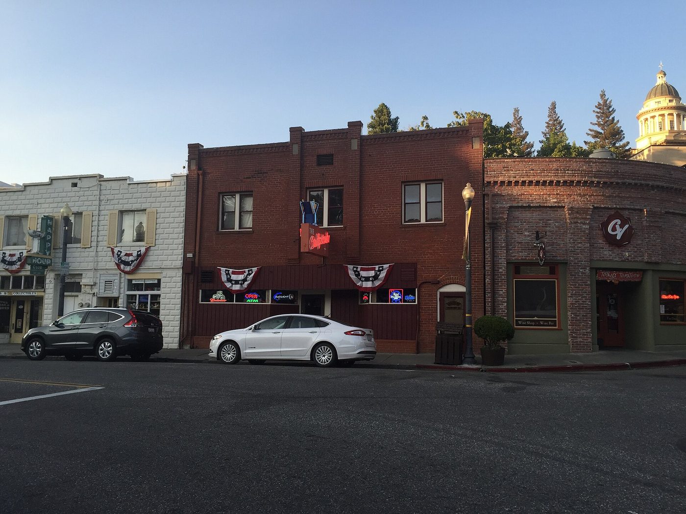
Stop 1 — Old Town Auburn and the North Fork American River
Mile 30 · about 10 minutes off I-80 · 45 minutes to 1 hour
Here is where we get out for coffee and a short walk. Old Town Auburn sits on the north fork of the American River and wears its Gold Rush history plainly: brick sidewalks, restored storefronts, and plaques about claims and miners. It is a compact place to stretch your legs after leaving the Bay Area and before tackling the long hill toward the Sierra Crest. There are a couple of very good bakeries and a handful of cafés clustered along the main street; pick a table on the sidewalk if the weather is clear.
Immediately above town, the North Fork American drops through a canyon that is a popular stretch for whitewater rafting and for short hikes. A quick riverside walk or a look at the old train trestles gives exactly the reset the car needs: shade, water noise, and a view of the foothills that you will be entering full-time before long. If you have bikes with you, the paved trails off the main street are excellent for a gentle half hour pedal before getting back on I-80.
If you have an extra 2 hours: Drive a few miles farther up the canyon to the Forest Hill Divide and the Auburn State Recreation Area trailheads. There are longer hikes and good vantage points over the river; in summer the wildflowers can be surprisingly vivid in the meadows.
Stop 2 — Donner Memorial State Park and Donner Lake, Truckee
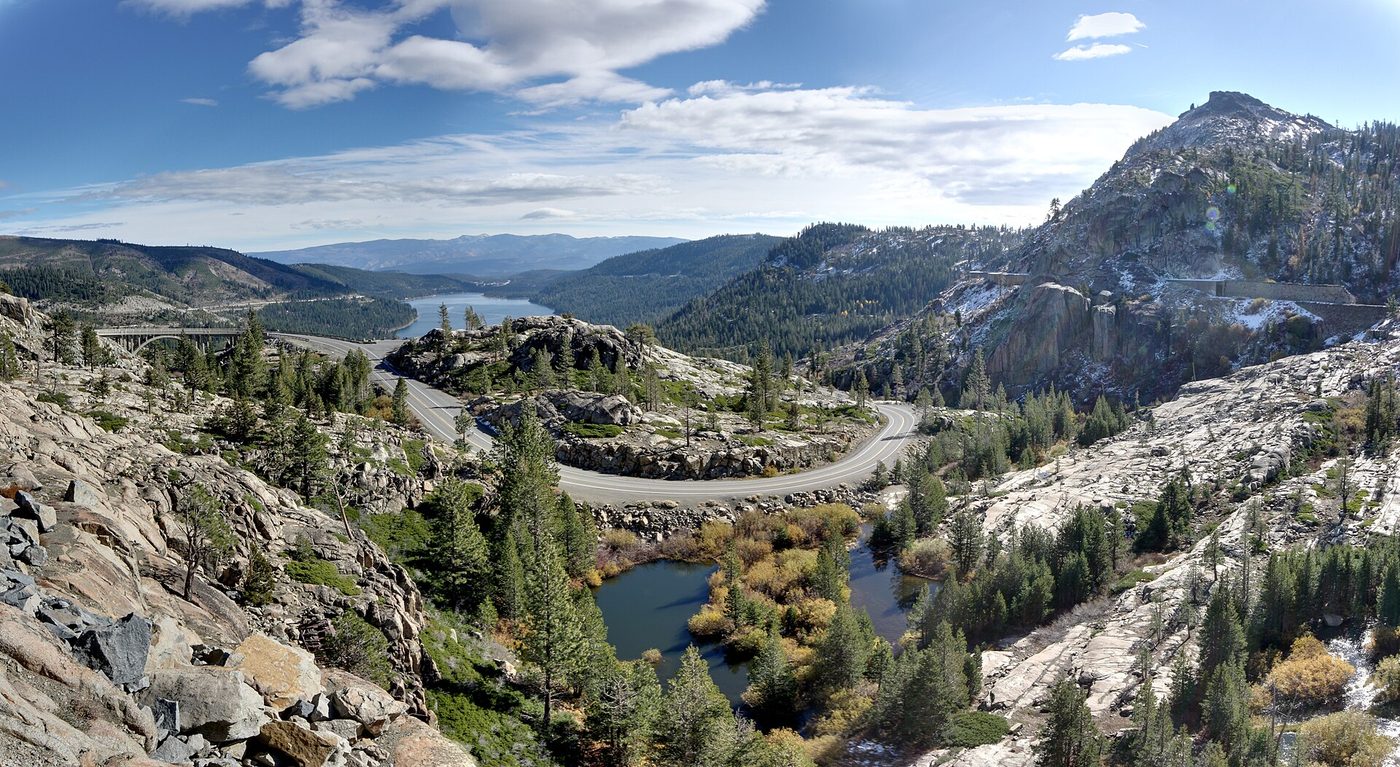
Mile 150 · right off I-80 at the Truckee/Donner exit · 45 minutes to 1 hour
This is the place on the drive where the Sierra makes its history visible: the small museum and the interpretive signs at Donner Memorial State Park tell a sobering story about the emigrant parties that spent the winter here in 1846–47. The memorial overlooks Donner Lake, and the viewpoint on the highway gives you one of the cleanest alpine-lake photos without a long detour. The town of Truckee, a few minutes from the park, has preserved its railroad-era core and is a good place for a more substantial lunch, a quick brewery stop, or a last-minute supply run for lake gear and parking passes.
The stretch of I-80 through Donner Pass has pulloffs and vistas that remind you you are climbing into serious country: granite knobs, lodgepole pines and the steep slopes where winters pile up. If you want a short walk, take the lakeshore path or a brief out-and-back to get closer to the water. Truckee's downtown is small but lively, with mountain shops and bakeries that do well by people who have driven up from the valley.
If you have an extra 90 minutes: Park in Truckee and walk the historic downtown blocks, or take the short trail to the edge of Donner Summit where you can see remnants of the old Transcontinental Railroad grade and rock cuts from the 1860s. It’s a crisp, quick history-break that pairs well with coffee.
Tell us where you are leaving from, when, and who is in the car — dog, toddler, EV, six-hour limit — and we will name the stops that actually fit. Your first trip is free, no card.
Stop 3 — Emerald Bay, Vikingsholm or Pope Beach (Lake Tahoe shore)
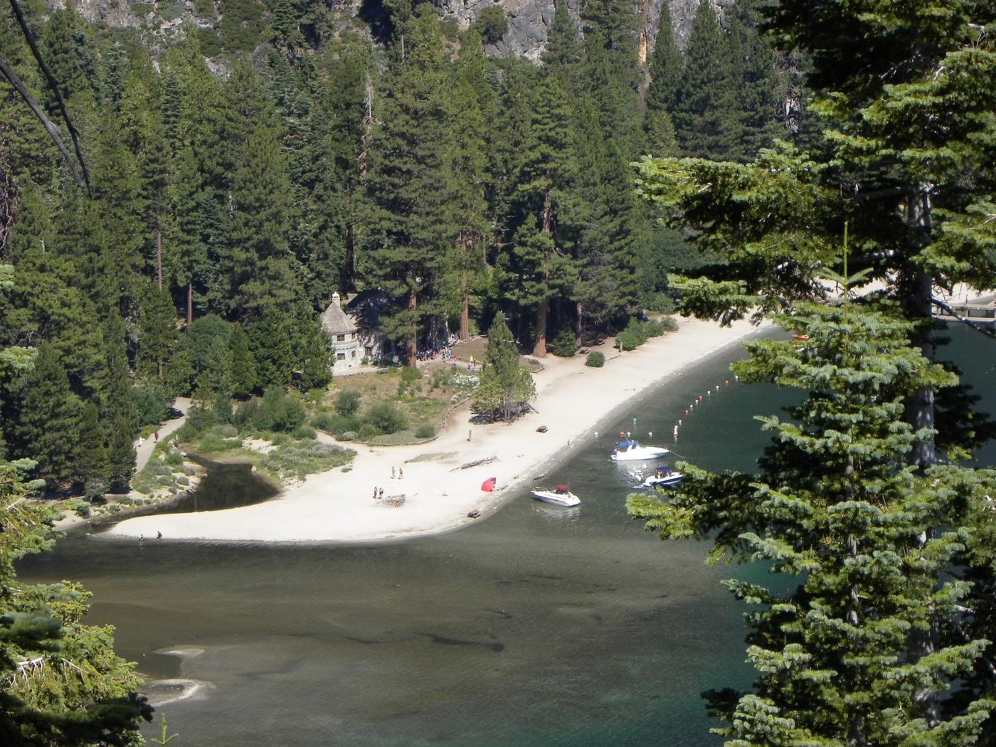
Mile 200 · on the lake shore, 5–20 minutes off the final highway depending on shore and parking · 45 minutes to 2 hours
Arriving at Lake Tahoe is that moment when the blue of the water cuts sharp against granite and pine. We usually save a shoreline stop for the end of the drive so people can get out and breathe, take photos, and decide whether to dive in (season permitting) or walk a short trail. Emerald Bay is our go-to if you want a classic Tahoe view and the option of a short, excellent walk down to Vikingsholm — a Scandinavian-style house tucked into a cove — or a longer shoreline hike. If you are bound for South Lake Tahoe, Pope Beach or Baldwin Beach are better options for sand and easy parking.
The lake is sensitive to crowds; parking at the most popular overlooks fills early on weekends in summer. If you want a quiet stop, pick a weekday or arrive early. If you are here for water activities, many of the tour boats and cruises that run in summer sell out on holiday weekends, so book ahead: book Tahoe cruises and tours ahead. For a more involved drive-and-listen experience as you trace the shoreline roads, there are self-guided audio options that are handy in the car and for the walks once you park: self-guided audio tour for the Lake Tahoe basin.
Why we put it last: it is the destination, and stopping here provides either an obvious finish to the day — the beach, the photo, a quick swim — or the opportunity to check in and unpack if you are staying. It’s also a good safety rule: fill up and buy perishables in Truckee before the final turn to the lake so you are not scrambling for a store in a parking-choked beach town.
Arriving at Lake Tahoe
Where you end up on the lake matters for what you want to do. South Lake Tahoe (Stateline) has casinos, a full-service town center, and the most straightforward route if you take US-50. The north and west shores — Tahoe City, Kings Beach, Homewood, Emerald Bay — are quieter, with easier access to trailheads and a more alpine, less commercial feel. If you are staying overnight, plan your arrival so you can park once and walk: summer parking time limits and permit rules vary by jurisdiction.
There are seasonal things to keep in mind. In summer the water is lovely but deceptively cold except on long hot stretches; bring layers and a towel. In shoulder seasons and winter, hauling gear up the mountain is simpler if you have space in the car and soft-sided bags. If you plan to ski, check resort opening dates and road advisories; if you plan to hike, check for recent trail conditions and any rules about dogs or permits for sensitive areas like Emerald Bay.
How we would time it
Leave San Francisco by 7:00 if you want a late-afternoon shoreline stop without the worst of weekend traffic. Breakfast in Auburn around 8:30 and a short walk along the river, back on I-80 by 9:30. Stop for lunch in Truckee between 12:30 and 1:30 and take the Donner Lake viewpoint and museum; fill the tank there. Arrive at the lake mid- to late-afternoon, check in to your lodging and walk the shore while the light is still good. If you are doing it the other way — leaving later and driving straight — aim for an early start the following morning for trails and water activities when the lake is calm.
Booking the rest of it
There are plenty of rental-car options from the Bay Area; compare EconomyBookings and GetRentacar if you want the best one-way deals or specialty vehicles for winter. If you are traveling in peak summer or over holiday weekends, reserve lodging and any boat or tour tickets ahead of time; a midweek stay will always feel quieter. If you are visiting in winter, call ahead about parking and chains, and consider starting the drive one day earlier to avoid last-minute chain stations.
The three stops on a map
Stops in driving order. Map data © OpenStreetMap contributors.
How far is San Francisco to Lake Tahoe and how long does it take?
Roughly 200 miles and about 3 hr 55 min of driving to the lake shore in clear conditions. Choosing I-80 toward Truckee or US-50 toward South Lake Tahoe changes mileage and time only modestly; traffic and weather are the main variables.
Which is the better route to Tahoe, I-80 or US-50?
Both work. I-80 to Truckee is the faster, northerly line to North and West Tahoe; US-50 through Placerville brings you into South Lake Tahoe and the southeast shore. Pick based on which part of the lake you want to reach and current traffic or chain-control conditions.
Do I need chains in winter to get to Lake Tahoe?
Possibly. The Sierra gets heavy snow and Caltrans may require chains or traction devices during storms. Check road conditions before you go and carry chains if the forecast calls for snow; many rental agencies will equip vehicles for winter if you request it.
What are the best places to stop between San Francisco and Tahoe?
Old Town Auburn for a short history and coffee stop; Donner Memorial State Park and Truckee for views, a museum and supplies; and a shore-side stop at Emerald Bay, Vikingsholm, or a beach on the south shore for photos and a walk.
Where should I fill up on gas and buy supplies?
Stock up before you climb the Sierra. Truckee and the towns along I-80/US-50 are the last reliable places for groceries, and prices can be higher near the lake and in peak season.
Now let us do this for your drive
Every stop above is one we would take ourselves — but it is our day, not yours. Change the departure time, the driving limit, the dog in the back seat, the EV that needs a charger every 200 miles, and the right stops change with it. That is the whole thing we built: you tell us the trip, we name the three good stops, with the drive math already done.
Leaving from somewhere else? Change the start and see your stops right now — your first trip is free, no signup.
Seeing your stops is free. The full plan — clock times, weather, what is open when you arrive — is free for your first trip, then 99¢ for three trips or $2.99 a month. If you just want to browse, we have stop-by-stop pages for thousands of routes.
We write one new drive a week — three real towns, the drive math, what we would skip. Leave an email and we will send them as they go up. No more than one a week, unsubscribe in a click.
Updated 2026-10-19. Some links on this page are affiliate links. If you book through one, we may earn a small commission at no extra cost to you. It never changes which stops we pick — no business on this page paid to be here.