Salt Lake City to Yellowstone: Three Good Stops on the Way to the West Entrance
Leaving from somewhere else? Change the start and see your stops right now — free, no signup.
About 320 miles from downtown Salt Lake City to the West Entrance at West Yellowstone, Montana — up I-15 through northern Utah and eastern Idaho, then US-20 into the mountains. Here is where we get out: a railroad station from the days when every train west stopped in Ogden, a waterfall that runs right through downtown Idaho Falls, and a thundering falls in the forest that most park-bound drivers pass within ten miles of and never see.
- 320 miles · three states
- 4 hr 45 min driving with clear roads
- I-15 N · US-20 N from Idaho Falls
- Salt flats and farm valleys to lodgepole forest
Salt Lake City is the closest big airport to Yellowstone's west side, and this is the drive that thousands of park visitors make every summer. It is an easy one: interstate for the first two-thirds, then a good four-lane highway, with no mountain passes worth worrying about. It is also long enough that the stops matter, because the last fuel and food you will want to rely on are in the towns, not the forest.
Out of Salt Lake City, I-15 runs north between the Wasatch Mountains and the Great Salt Lake, past Ogden and Brigham City, and crosses into Idaho at about mile 110. From there it is open sagebrush and farmland past Pocatello to Idaho Falls. At Idaho Falls you leave the interstate for US-20, which climbs gently past Rexburg and the potato country around Ashton into the forests of the Island Park caldera before it reaches the Montana line and the town of West Yellowstone.
One thing to plan for: the West Entrance is the busiest gate into the park in summer, and the line of cars can back up into town by mid-morning. If your goal is to get into the park the same day, arrive in the afternoon and go in the next morning early, or push on in the evening when the line is gone.
Stop 1 — Union Station and Historic 25th Street, Ogden
Mile 38 · about 5 minutes off I-15 · 45 minutes to 1 hour
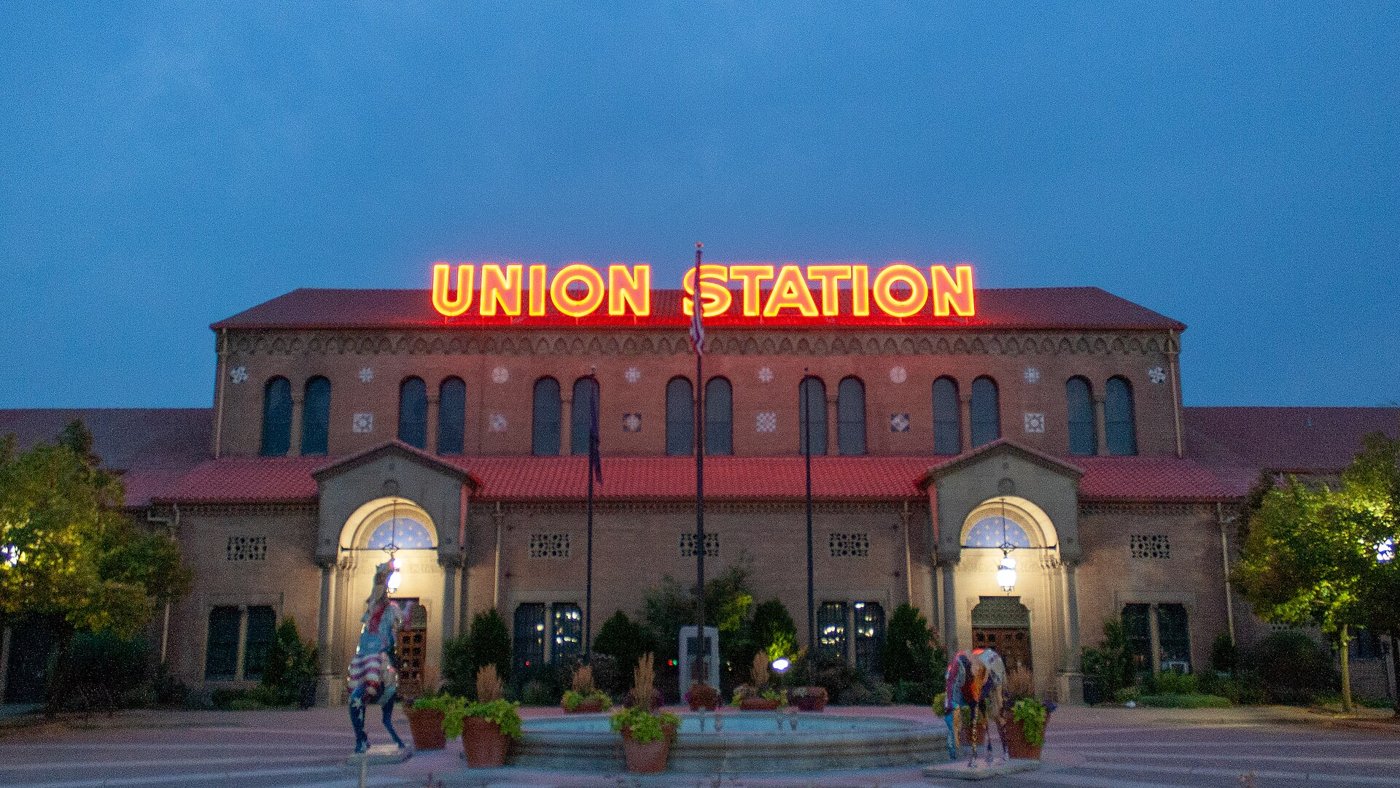
When the transcontinental railroad was finished in 1869, Ogden became the junction where the lines met, and for decades nearly every passenger crossing the West by train changed here. The red-tiled Union Station at the foot of 25th Street was built in the 1920s after a fire destroyed the earlier depot, and today it houses a set of small museums, including a railroad museum with big locomotives on the tracks out back and a collection devoted to the Browning firearms family, who were from Ogden.
The street leading away from the station, Historic 25th Street, was once a rough strip of saloons and boarding houses that served the railroad crowd. Now its brick storefronts hold coffee shops, bakeries and restaurants, and it is the best place on the whole drive for a proper breakfast or an early lunch before the long empty stretch north. Park once and walk it end to end.
If you have an extra 2 hours: Golden Spike National Historical Park at Promontory Summit, where the last spike of the transcontinental line was driven, is about 30 miles west of I-15 from Brigham City. Replica steam engines run on the original grade in summer.
Stop 2 — The falls and Greenbelt, Idaho Falls
Mile 210 · about 3 minutes off I-15 · 30 to 45 minutes
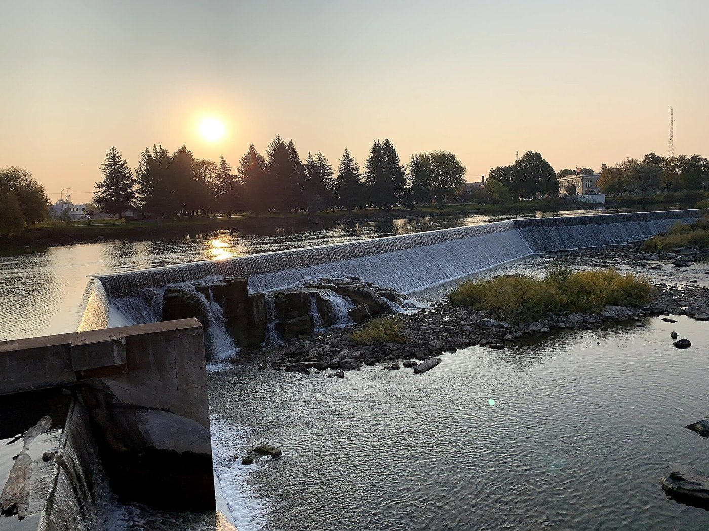
The city is named for them, and they are right downtown. The Snake River drops over a long, low ledge of black lava rock here, widened and shaped over the years by a diversion weir, so the water pours in one white sheet across most of the river's width. It is not tall, but it is wide and loud, and on a summer evening with the sun going down behind it, it is one of the nicest city views in Idaho.
A paved path called the Greenbelt runs along both banks, with benches, lawns and footbridges, and it is exactly what you want after three hours in the car: flat, shady, and free. Across the river stands the white tower of the Idaho Falls temple, which you will see from the path. Downtown, a few blocks from the water, has restaurants and the Museum of Idaho. This is also the last big town on the drive, so fill the tank and buy groceries or snacks before you turn onto US-20.
Tell us where you are leaving from, when, and who is in the car — dog, toddler, EV, six-hour limit — and we will name the stops that actually fit. Your first trip is free, no card.
Stop 3 — Upper Mesa Falls, Mesa Falls Scenic Byway
Mile 280 · on the Idaho 47 loop from Ashton · 30 to 45 minutes
At Ashton, most drivers stay on US-20 and roll straight on to the park. Instead, take Idaho 47, the Mesa Falls Scenic Byway, a quiet two-lane road through the Caribou-Targhee National Forest that loops back to US-20 near Island Park. It adds only about 20 minutes, and it passes the best waterfall on the drive.
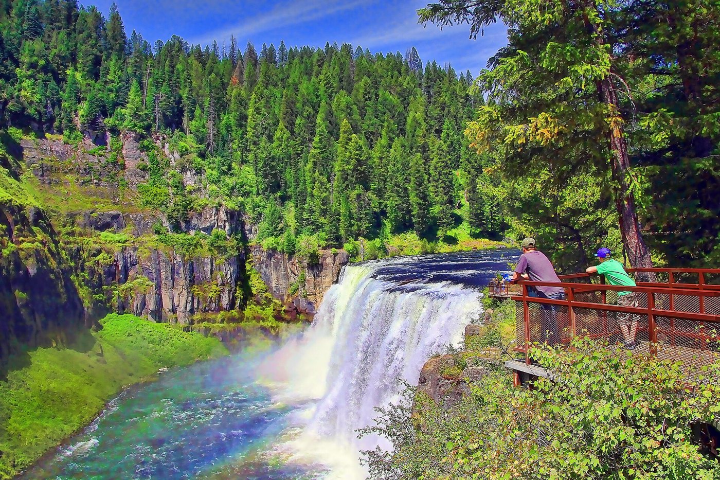
Upper Mesa Falls is where Henrys Fork of the Snake River drops about 114 feet over a cliff of volcanic rock in a curtain about 200 feet wide. A boardwalk and stairs take you down to overlooks right beside the brink, close enough to feel the spray and, on sunny afternoons, to see rainbows in the mist. The restored lodge at the parking area works as a small visitor center. There is a modest parking fee. A few miles back down the road, a pullout looks across the canyon to Lower Mesa Falls, smaller and farther away but worth the two-minute stop.
Why we put it last: it is only about 50 minutes from West Yellowstone, so it works as the last leg-stretch before the park, and it gives you a preview of the volcanic landscape you are about to enter. Note that the byway closes to cars in winter and usually reopens in late spring; check before you go if you are early in the season. If you have more time, Big Springs, just east of US-20 at Island Park, is the spring that feeds Henrys Fork, and from the footbridge you can watch huge trout in the clear water below.
Arriving at Yellowstone
West Yellowstone is a small town built around the park gate, with motels, restaurants, gas and the Yellowstone Grizzly and Wolf Discovery Center, where you can see both animals up close if the park does not oblige. From the West Entrance, the road follows the Madison River, a good place to see bison and elk, to Madison Junction, and Old Faithful is about 30 miles and an hour from the gate. There is a park entrance fee per vehicle, and an annual national parks pass covers it. For guided wildlife and geyser trips, book Yellowstone tours and wildlife trips ahead; for a story to play as you drive the loop roads, there is a self-guided audio tour for the drive through the park.
How we would time it
Leave Salt Lake City by 7:30. Breakfast on 25th Street in Ogden at 8:15 and a look around Union Station. Back on I-15 by 9:30 and into Idaho Falls around 12:30 for lunch and a walk on the Greenbelt. Gas up and turn onto US-20 by 1:45. Take the Mesa Falls loop from Ashton and reach Upper Mesa Falls around 3. Into West Yellowstone by about 4:30, check in, and drive into the park in the early evening, when the line at the gate is short and the animals come out.
Booking the rest of it
Salt Lake City's airport has the most rental cars and the best prices for this drive, and one-way rentals to the small airports near the park can be expensive, so many people make it a round trip. Compare EconomyBookings and GetRentacar. Lodging inside the park and in West Yellowstone fills months ahead for July and August, so book your room before you book anything else.
The three stops on a map
Stops in driving order. Map data © OpenStreetMap contributors.
How far is Salt Lake City to Yellowstone and how long does it take?
About 320 miles and 4 hr 45 min of driving to the West Entrance at West Yellowstone, Montana, on I-15 North and US-20 North. The Mesa Falls Scenic Byway loop adds about 20 minutes. Plan on 7 to 8 hours with stops.
What are the best stops between Salt Lake City and Yellowstone?
Union Station and Historic 25th Street in Ogden, about 5 minutes off I-15; the falls and Greenbelt path on the Snake River in downtown Idaho Falls; and Upper Mesa Falls, a 114-foot waterfall on the Mesa Falls Scenic Byway between Ashton and Island Park.
Which Yellowstone entrance is closest to Salt Lake City?
The West Entrance at West Yellowstone, Montana, is the most direct by road from Salt Lake City. The South Entrance via Jackson and Grand Teton National Park is another option and a little longer.
Is the Mesa Falls Scenic Byway worth the detour?
Yes, from late spring to fall. It adds only about 20 minutes over staying on US-20, and Upper Mesa Falls has boardwalk overlooks right beside the falls. The byway closes to cars in winter, so check road status early in the season.
Where should I get gas between Salt Lake City and Yellowstone?
Idaho Falls is the last large town on the route, so fill up there before turning onto US-20. Rexburg, Ashton, Island Park and West Yellowstone also have gas, and prices are usually higher closer to the park.
Now let us do this for your drive
Every stop above is one we would take ourselves — but it is our day, not yours. Change the departure time, the driving limit, the dog in the back seat, the EV that needs a charger every 200 miles, and the right stops change with it. That is the whole thing we built: you tell us the trip, we name the three good stops, with the drive math already done.
Leaving from somewhere else? Change the start and see your stops right now — free, no signup.
Seeing your stops is free. The full plan — clock times, weather, what is open when you arrive — is free for your first trip, then 99¢ for three trips or $2.99 a month. If you just want to browse, we have stop-by-stop pages for thousands of routes.
We write one new drive a week — three real towns, the drive math, what we would skip. Leave an email and we will send them as they go up. No more than one a week, unsubscribe in a click.
Updated 2026-10-02. Some links on this page are affiliate links. If you book through one, we may earn a small commission at no extra cost to you. It never changes which stops we pick — no business on this page paid to be here.