Portland to Bend: Three Good Stops on the Mount Hood–High Desert Drive
Leaving from somewhere else? Change the start and see your stops right now — your first trip is free, no signup.
About 165 miles from downtown Portland to central Bend — mostly US-26 east over Mount Hood, then US-97 south into Central Oregon. Here is where we get out: a mountain lodge and lake with classic Mount Hood views, a small but essential museum that explains the place you're entering, and a canyon-side state park of spires and cliffs that makes Bend feel inevitable.
- 165 miles · two highway corridors (US-26, US-97)
- 3 hr 30 min driving with clear roads — real travel time depends on winter chains and traffic near Mount Hood
- US-26 East over Mount Hood · US-97 South into Bend
- Alpine forests and volcanic terrain to high desert and river canyons
Portland to Bend is one of those drives that gives you two very different Oregons in a single afternoon: the green, conifered flank of Mount Hood where the air smells like resin, then, a few hours later, the open, sun-baked high desert and the volcanic rock that makes Central Oregon so particular. The highway is straightforward and scenic: for most of us the natural line is US‑26 out of Portland, over the Mount Hood corridor (Sandy, Government Camp), then east across the Warm Springs plateau toward Madras where you pick up US‑97 and descend into the Deschutes basin toward Redmond and Bend.
We’ve kept the stops close enough that you’re never wasting a half day on getting out of the car, but far enough apart that each one feels like a proper destination and resets the drive. The short rules to plan by: expect busy parking lots around Mount Hood on summer weekends; Wind and dust are more of a factor on the plateau; and Smith Rock draws early crowds for sunrise and late‑afternoon photographers. Gas and groceries are best handled in Sandy or Madras — once you pass Warm Springs you’re in small‑town country until Bend.
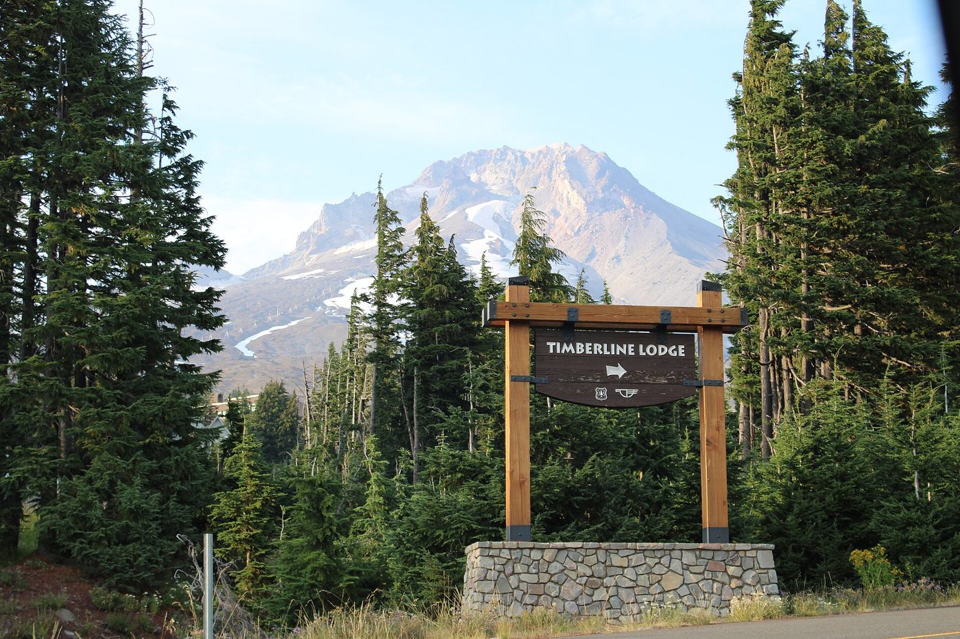
Stop 1 — Timberline Lodge and Trillium Lake, Mount Hood
Mile 60 · about 20–30 minutes off the Portland city limits · 45 minutes to 1 hour (longer if you walk)
This is the Mount Hood stop everyone expects. From Portland we follow US‑26 east through Sandy and up the Mount Hood Highway to Government Camp; a few miles above the village the lodge and access roads appear as the trees open. Timberline Lodge sits high on Mount Hood’s south side — it’s a 1930s WPA building with big stone chimneys and a pine‑timber silhouette that reads well in photos. Spend a short while on the lodge terrace for a mountain coffee and the photo angle, and then continue a few minutes down the road to Trillium Lake, where on calm days Hood reflects perfectly in the water.
We like this stop for a couple of reasons: it breaks the city-to-mountain run at a place that feels like a destination, not a gas station; the lodge has bathrooms and a cafeteria service in season; and Trillium Lake is the easiest way to stretch legs on a fairly flat, well-marked loop with one of the classic Mount Hood reflections. In winter, chain controls and restricted access can change the plan — check local road reports and aim to travel midday when avalanche control and plowing are most likely to be current.
If you have an extra 2 hours: swap a cup of coffee for a short hike — the Mirror Lake or Trillium loop is under 2 miles and pleasant — or take the ridge trail above Timberline for a stronger look at the mountain and the Palmer Glacier.
Stop 2 — The Museum at Warm Springs and the high‑desert approach
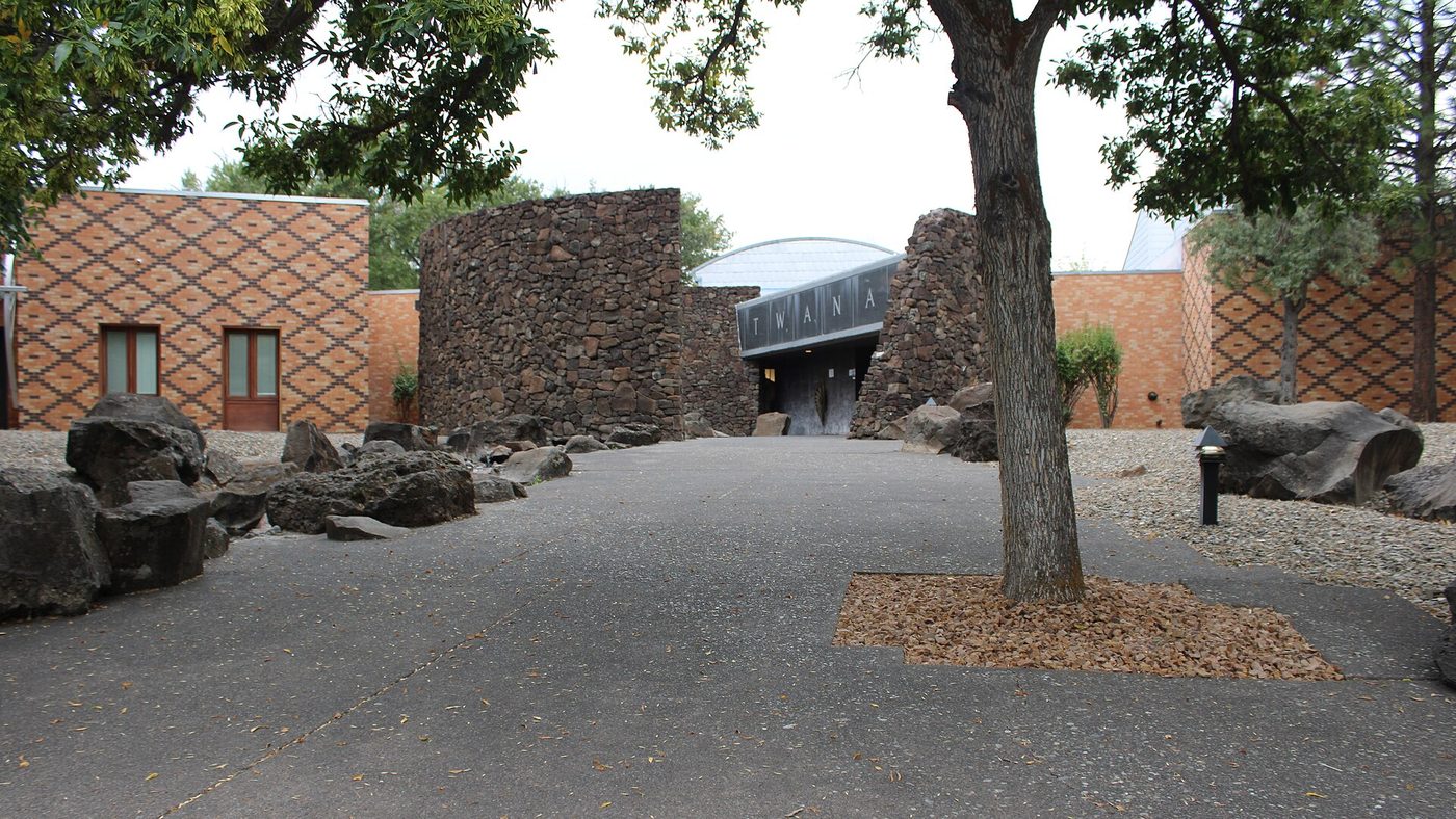
Mile 115 · right on US‑26 at Warm Springs · 30 to 45 minutes
Password: context. The landscape changes a lot after Mount Hood: forests thin to juniper and sage, the air dries, and the view opens to a broad, basalt‑cut plateau. Warm Springs is where the Confederated Tribes of Warm Springs are based, and the small but carefully done The Museum at Warm Springs is exactly the sort of stop that improves your visit to Central Oregon. The exhibits explain tribal history, local lifeways and the land — and that extra context makes the next hours on US‑26 and US‑97 feel less like scenery and more like a place people live in and have always lived in.
There are picnic tables and a modest gift shop, and this is also a practical mid‑drive place to check tires, buy a snack, or use a good restroom before you cross the plateau toward Madras. From Warm Springs the high desert around Madras is close at hand; it’s the place where the road narrows and the long views begin to sketch out the volcanic features you’ll be driving into.
If you have an extra hour: pull into Madras for a stronger lunch stop and a short walk at a viewpoint above the river or through the town center for a local coffee and bakery — Madras is the last real service town before you head down to Smith Rock and Bend.
Tell us where you are leaving from, when, and who is in the car — dog, toddler, EV, six-hour limit — and we will name the stops that actually fit. Your first trip is free, no card.
Stop 3 — Smith Rock State Park (Terrebonne), Crooked River canyon
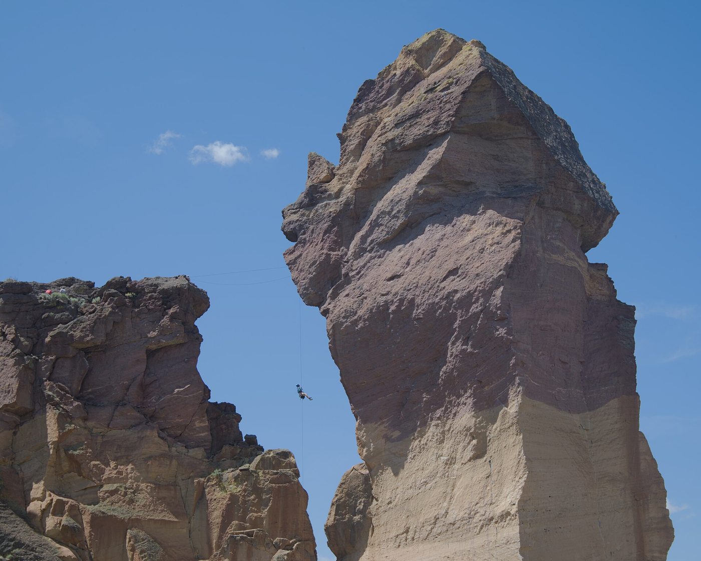
Mile 150 · about 10 minutes off US‑97 at the Terrebonne turn · 45 minutes to 2 hours
We put this one last because it is the picture you’re driving toward. Smith Rock State Park is a handful of towering rhyolite spires, sheer canyon walls and a braided loop trail that gives superb close views of the Crooked River and the cliffs that made American sport climbing famous. Pull in to the day‑use lot and pick a short route: the Crescent Rock viewpoint and the lower canyon walks are quick and give dramatic views; if you have more time and legs, the Misery Ridge loop climbs to the rim for a panoramic view of the Three Sisters and the river below.
The place can be busy; day‑use parking fills on summer weekends and early in the morning is the sweetest time for light and relatively empty trails. There is a modest day‑use fee and vault toilets in the lots; no large services inside the park, so treat this as a scenic hike and photo stop rather than a place to solve vehicle problems. From Smith Rock it’s about 30–40 minutes into Bend depending on traffic and how long you linger on the rim.
Why we put it last: it’s the most striking, and it works as a final stretch before Bend — you leave the canyon and the road opens back to farmland and then the wide Deschutes valley. If you stopped earlier for lunch and hiking, Smith Rock is the recharge the whole trip builds toward.
If you have an extra half day: stay for a longer hike (Misery Ridge + Summit loop) or book a local guide if you’re interested in learning about climbing history or getting on a beginner’s top‑rope. Campgrounds and private rentals are nearby if you want to wake up in the canyon for sunrise.
Arriving at Bend
Bend is a compact outdoor town with full services: breweries, gear shops, good restaurants, and the Deschutes River running through the middle. If you’re staying in the historic downtown expect easy walkability; if you booked a river cabin or an Airbnb on the river, you’ll be near trails and paddle launches. From Smith Rock the approach to Bend is an easy drive down US‑97 and then into town; Redmond is the small city you pass en route and has additional lodging and airport options if you need them.
How we would time it
Leave Portland by 7:30 a.m. to avoid rush-hour snarls and to get a clear run on the Mount Hood corridor. Arrive at Timberline or Trillium around 9:00 a.m. for coffee and a 45‑minute walk; back on the road by 10:00. Plan for a short bookend stop in Warm Springs around noon — museum, snack and a quick leg stretch — then push on to Madras for any fuel or groceries you need. Leave Madras mid‑afternoon and stop at Smith Rock around 3:30–4:00 p.m.; that gives you time to hike a viewpoint loop and still arrive in Bend before dinner. If you prefer a slower trip, turn the day into an overnight in Sisters or Redmond and save Smith Rock for a sunrise visit the next morning.
Booking the rest of it
Portland International (PDX) is the obvious arrival airport and where most rental fleets are largest and cheapest; one‑way rentals into Redmond or Bend are possible but sometimes pricey. Compare EconomyBookings and GetRentacar when you’re booking. Lodging in Bend and Redmond fills up for holidays and craft‑beer festival weekends months in advance, and Smith Rock nearby lodging (motels, cabins, campgrounds) can sell out on summer weekends — book sooner rather than later.
Notes and cautions: in winter the Mount Hood corridor can see chain controls and closures for avalanche control; the Warm Springs plateau and US‑97 in early spring can still have slick alternate conditions. Cell service is intermittent on parts of the route, so download directions or have an offline map if your trip is out of season. Fill up in Madras if you’re worried about range — it’s the last full town before the Deschutes valley depending on which side roads you take.
The three stops on a map
Stops in driving order. Map data © OpenStreetMap contributors.
How far is Portland to Bend and how long is the drive?
About 165 miles and roughly 3 hr 30 min of driving without stops on the US‑26 / US‑97 route. With the three stops suggested here plan on 5–7 hours total for a day trip.
Which route should I take from Portland to Bend?
The usual and scenic route is US‑26 east over Mount Hood (through Sandy and Government Camp) then US‑97 south from Madras to Bend. It’s the fastest scenic corridor and gives the best access to Mount Hood and the high desert.
What if I’m driving in winter — any special planning?
Winter can impose chain controls on the Mount Hood corridor and occasional slowdowns on US‑97. Allow extra time, carry chains if conditions call for them, check state road reports before you leave, and plan to travel during daylight for the safest run.
Are the stops good for families with kids or dogs?
Timberline and Trillium Lake are family‑friendly and dog‑friendly on short leashes; the Museum at Warm Springs is a short indoor stop (check opening hours) and Smith Rock has steep cliffs so keep dogs on leash and stay away from fragile edges. For toddlers, choose shorter loops and pick picnic areas rather than long hikes.
Where should I get gas before heading into the high desert?
Fill up in Sandy or Madras. Madras is the last larger town with multiple stations before you commit to the US‑97 stretch into Central Oregon and the smaller towns around Bend.
Now let us do this for your drive
Every stop above is one we would take ourselves — but it is our day, not yours. Change the departure time, the driving limit, the dog in the back seat, the EV that needs a charger every 200 miles, and the right stops change with it. That is the whole thing we built: you tell us the trip, we name the three good stops, with the drive math already done.
Leaving from somewhere else? Change the start and see your stops right now — your first trip is free, no signup.
Seeing your stops is free. The full plan — clock times, weather, what is open when you arrive — is free for your first trip, then 99¢ for three trips or $2.99 a month. If you just want to browse, we have stop-by-stop pages for thousands of routes.
More road trip guides
- Seattle to Portland
- Phoenix to Grand Canyon
- San Diego to Los Angeles
- New York to Washington, D.C.
- San Francisco to Lake Tahoe
- New York to Philadelphia
- All road trip guides
We write one new drive a week — three real towns, the drive math, what we would skip. Leave an email and we will send them as they go up. No more than one a week, unsubscribe in a click.
Updated 2026-11-10. Some links on this page are affiliate links. If you book through one, we may earn a small commission at no extra cost to you. It never changes which stops we pick — no business on this page paid to be here.