San Francisco to Los Angeles on Highway 1: Three Good Stops
Leaving from somewhere else? Change the start and see your stops right now — free, no signup.
Roughly 460 miles of coast if you take the slow road, and you should. This is not a drive to optimise — it is the drive. Here is where we get out: an aquarium worth half a day, the cliffs at Big Sur, and a beach full of elephant seals.
- 460 miles
- 10-11 hr driving
- CA-1 · US-101
- A real two-day drive, three if you can
You can do San Francisco to Los Angeles in about six hours on I-5, and if you need to be there tonight, do that. Highway 1 is a different decision. It is nearly twice the time, most of it two lanes with no shoulder and no cell service, and it is the most beautiful road in the country.
Two things to settle before you leave. First, go southbound — the ocean is on your side of the road and every pullout is a right turn. Second, check the road. Big Sur closes. Landslides shut sections of CA-1 for months at a time, and the detour is back over the mountains. Caltrans posts current closures; look before you commit.
Stop 1 — Monterey
Mile 120 · directly on the route · half a day, or overnight
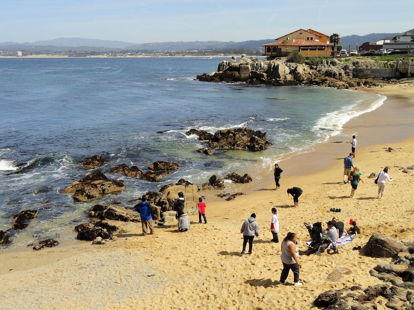
Santa Cruz comes first and has the boardwalk if you have kids who need it, but Monterey is where we would spend the time. The Monterey Bay Aquarium sits on Cannery Row on the site of a former sardine cannery, looks straight into the kelp forest of the bay, and is worth two to three hours even for adults who think they are done with aquariums. It is popular enough that walk-up entry can sell out, so book Monterey Bay Aquarium tickets before you go.
Next door, Cannery Row itself is the street Steinbeck wrote about, and the seventeen-mile drive around Pebble Beach and out to Point Lobos gives you the first serious coastline of the trip. Point Lobos State Natural Reserve, just south of Carmel, is where we would walk if we only had an hour.
Why we put it here: after Monterey the road gets slow and the services thin out. Eat properly, top up the tank, and use a real bathroom before Big Sur.
Stop 2 — Big Sur
Mile 150 to 220 · the route itself · 3 hours minimum
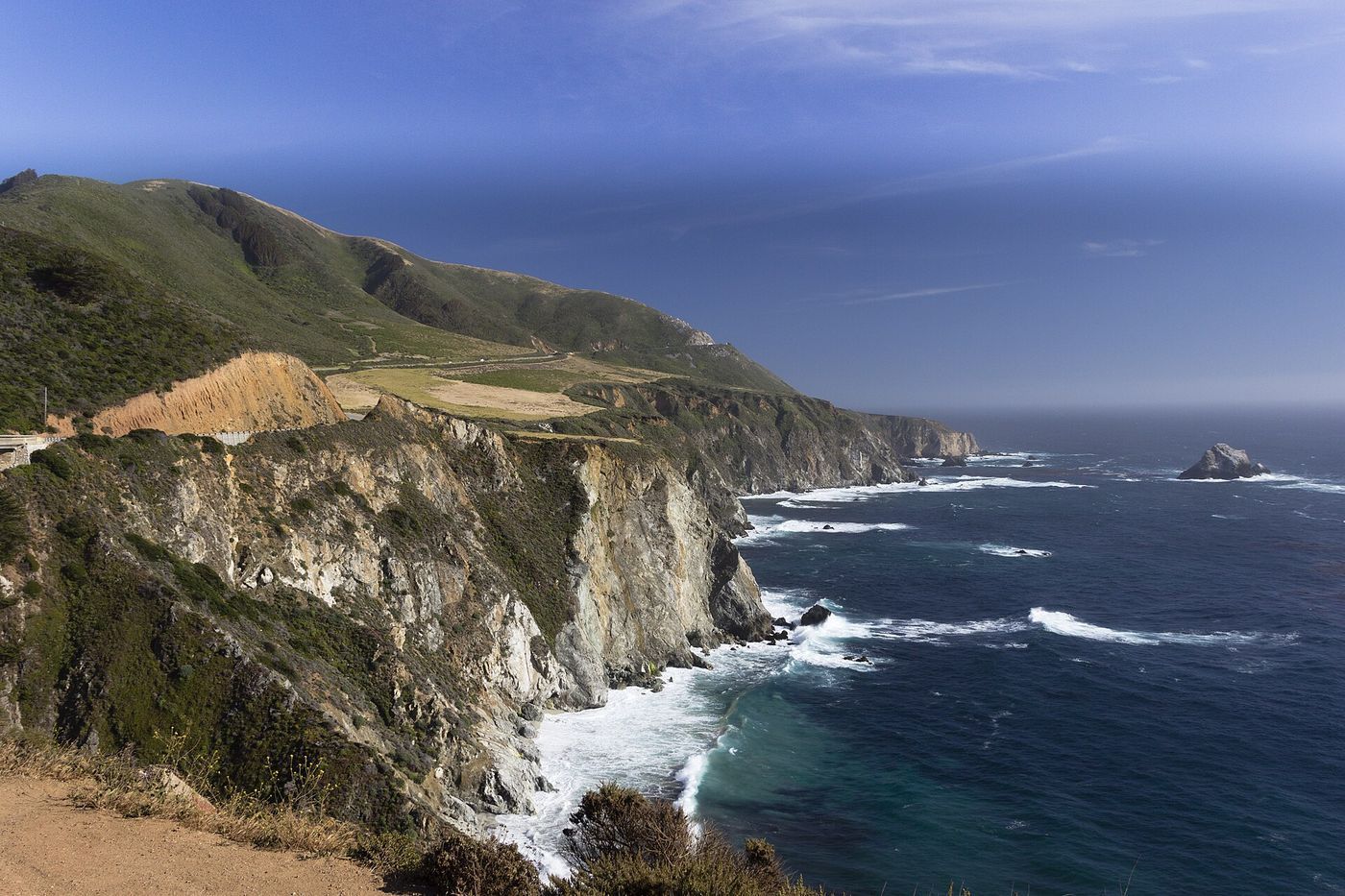
Big Sur is not a town, it is about seventy miles of the Santa Lucia Range dropping straight into the Pacific. Bixby Creek Bridge, at the north end, is the arch everybody photographs and there is a pullout on the north side. Further south, Julia Pfeiffer Burns State Park has the overlook trail to McWay Falls, an eighty-foot waterfall that lands on a beach in a cove — a short, flat walk from the parking area.
Rules of this stretch: gas is scarce and expensive, cell service is effectively gone, and the pullouts fill up. Do not plan a schedule through here. Plan a window.
If you would rather understand what you are looking at than guess, an self-guided audio tour you play as you drive keeps talking when the signal drops, which is the whole problem with streaming anything along this coast.
Tell us where you are leaving from, when, and who is in the car — dog, toddler, EV, six-hour limit — and we will name the stops that actually fit. Your first trip is free, no card.
Stop 3 — San Simeon and Piedras Blancas
Mile 245 · directly on the route · 1 to 2 hours
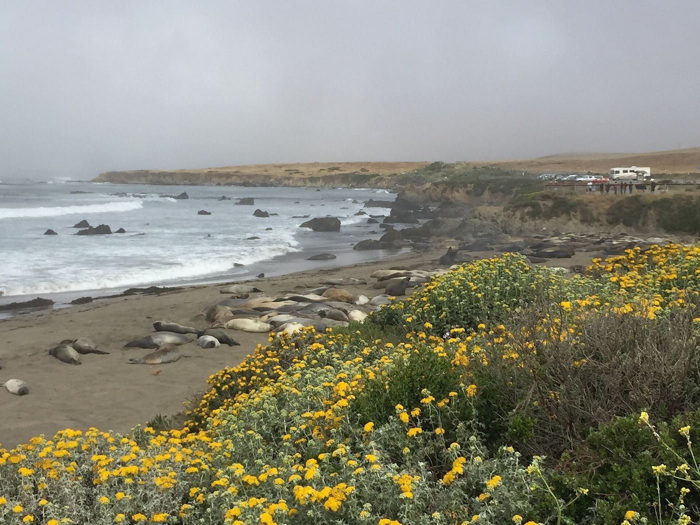
Coming out of Big Sur the land flattens and two things sit within a few miles of each other. The Piedras Blancas elephant seal rookery is a boardwalk viewing area right off CA-1 north of San Simeon where northern elephant seals haul out — animals the size of a car, a few metres away, free to watch, no reservation. Peak season for births and breeding is winter; there are usually seals on the sand in some number most of the year.
A few minutes south, Hearst Castle sits up on the hill: William Randolph Hearst's estate, now a state historic park, seen only on a guided tour that leaves from the visitor centre by shuttle. Tours are timed and sell out, so it is a decision to make before you are standing in the car park, not after.
From here it is another four hours or so to Los Angeles through San Luis Obispo, Pismo Beach and Santa Barbara — any of which makes a better second night than pushing into LA traffic after dark.
How we would time it
Two nights is the honest answer. Night one in Monterey or Carmel, night two in Cambria or San Luis Obispo, into LA mid-afternoon on day three. One night works if you start early and treat Big Sur as the day rather than a section of it.
Booking the rest of it
Most people fly into one end of this drive and out of the other, which makes it a one-way rental. Compare EconomyBookings and GetRentacar before you book at the airport counter — the SFO-to-LAX drop fee varies a lot more than the daily rate does.
The three stops on a map
Stops in driving order. Map data © OpenStreetMap contributors.
How long does it take to drive Highway 1 from San Francisco to Los Angeles?
About 460 miles and ten to eleven hours of driving. Two days is the realistic minimum and three is better. I-5 does the same trip in roughly six hours but shows you nothing.
Should I drive Highway 1 north or south?
South. Driving southbound puts you in the lane next to the ocean, so every viewpoint and pullout is a right turn instead of a left across traffic.
Is Big Sur open?
Sometimes not. Landslides close sections of CA-1 through Big Sur for extended periods. Check the current Caltrans closure list before you leave, because the detour is long.
Where do you see elephant seals on Highway 1?
At the Piedras Blancas rookery just north of San Simeon. There is a free boardwalk viewing area directly off CA-1.
Now let us do this for your drive
Every stop above is one we would take ourselves — but it is our day, not yours. Change the departure time, the driving limit, the dog in the back seat, the EV that needs a charger every 200 miles, and the right stops change with it. That is the whole thing we built: you tell us the trip, we name the three good stops, with the drive math already done.
Leaving from somewhere else? Change the start and see your stops right now — free, no signup.
Seeing your stops is free. The full plan — clock times, weather, what is open when you arrive — is free for your first trip, then 99¢ for three trips or $2.99 a month. If you just want to browse, we have stop-by-stop pages for thousands of routes.
We write one new drive a week — three real towns, the drive math, what we would skip. Leave an email and we will send them as they go up. No more than one a week, unsubscribe in a click.
Updated 2026-09-06. Some links on this page are affiliate links. If you book through one, we may earn a small commission at no extra cost to you. It never changes which stops we pick — no business on this page paid to be here.