San Francisco to Yosemite: Three Good Stops on the Way to Yosemite Valley
Leaving from somewhere else? Change the start and see your stops right now — your first trip is free, no signup.
About 190–195 miles from downtown San Francisco to Yosemite Valley — roughly 3 hr 50–4 hr driving without heavy traffic. Here is where we get out: a neat early stop for coffee and a walk in the Livermore valley, a preserved steam-rail shop that’s been in hundreds of movies, and Groveland’s old saloon-and-main-street scene that sets the mood before the mountains.
- 191 miles · Bay Area to high country
- 3 hr 56 min driving with clear roads
- I-580 E / I-205 E then CA-120 (Big Oak Flat) or CA-140 (Arch Rock)
- Valley floor and orchards up to granite cliffs and waterfall viewpoints
There are three common lanes into Yosemite from the Bay Area and each feels different: CA-120 (Big Oak Flat) is the straightforward, fastest lane through Oakdale and Groveland; CA-140 through Merced and Mariposa follows the Merced River canyon and is the most forgiving in winter; CA-41 from Fresno climbs toward Wawona and the south park features. From San Francisco most drivers choose CA-120 unless they have a reason to come from the south. In any case, the last reliable services are in the timber towns and valley gateways rather than the park itself, so we plan our stops around fuel, a short walk, and a place that gives you a sense of arriving.
Roads can change with weather: Tioga Road (the eastern / high-country corridor on CA-120) is seasonal and closures or chain requirements are possible on any of the mountain highways in winter. If you have an EV, Livermore and the bigger towns along the valley are where you’ll find charging; once you climb toward Groveland the options thin.
Stop 1 — Livermore and the Altamont corridor
Mile 35 · about 5–10 minutes off I-580 · 30 to 60 minutes
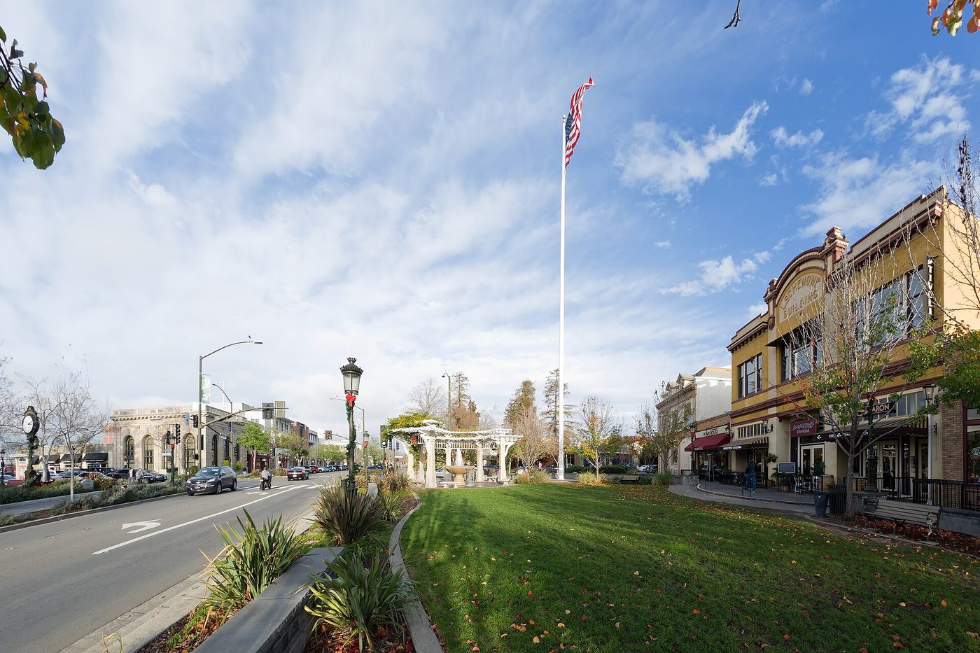
If you’re leaving the city in the morning, this is where we pause for real coffee and a flat place to stretch. Livermore is the most convenient first stop after the Bay Bridge/I-580 corridor: there are quality cafés and bakeries clustered near First Street and the old downtown, a pair of grocery options if you forgot snacks, and an easy park or vineyard walk to wake up the legs. The wind turbines on the Altamont ridgeline are visible from parts of the highway — it’s one of those California landscape postcards where modern infrastructure and farming meet the low rolling hills.
Why stop here: it breaks the urban-to-farm transition without adding time. The roads are wide, parking is simple, and if you need to plug in an EV you’ll usually find chargers at the big-box grocery lots or downtown parking. If you have an extra hour, take a quick loop to one of the valley wineries for a patio rest; some tasting rooms open early enough that you can sit in the shade and watch the morning light on the vines.
If you have an extra 2 hours: try the Livermore Valley Wine Trail for an easy, civilized detour — tasting rooms are close together and you’ll be back on I-580 without losing the day.
Stop 2 — Railtown 1897 State Historic Park, Jamestown (movie railroad)
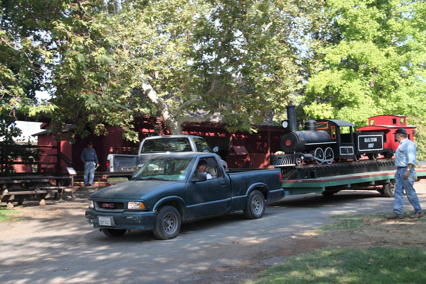
Mile 128 · about 20–35 minutes off CA-120 via Sonora/CA-108 if you detour · 1 to 1.5 hours
The Sierra Railway’s old shops at Jamestown are the treasure of the Mother Lode: a working roundhouse, a handful of steam and classic diesel locomotives, and a parade of preserved cars and shop buildings that have been used in hundreds of films and television shows. The park runs steam and diesel excursion trains on a schedule through the season, and even if the engines aren’t running the roundhouse and the museum are worth the walk. For kids and anyone who likes industrial kitsch, it’s a hands-on piece of the old railroad economy and it’s dramatically quieter than the highway that brought you there.
How the detour works: staying on CA-120 will take you through Oakdale and on toward Big Oak Flat; to reach Jamestown you leave CA-120 at Oakdale and swing north on CA-108 through Sonora to Jamestown. The detour adds about 20–35 minutes of driving time from the main CA-120 line, but it lets you spend an hour among steam-era buildings and get a stronger sense of Gold Country. There are picnic tables, a small gift shop, and often a scheduled train run on weekends in the season.
If you have an extra 2 hours: combine Railtown with nearby Columbia State Historic Park (gold-rush main street and panning experiences) for a proper Mother Lode afternoon; it’s classic old-west atmosphere and a good place to pick up sandwiches and trail snacks before the mountains.
Tell us where you are leaving from, when, and who is in the car — dog, toddler, EV, six-hour limit — and we will name the stops that actually fit. Your first trip is free, no card.
Stop 3 — Groveland and Big Oak Flat
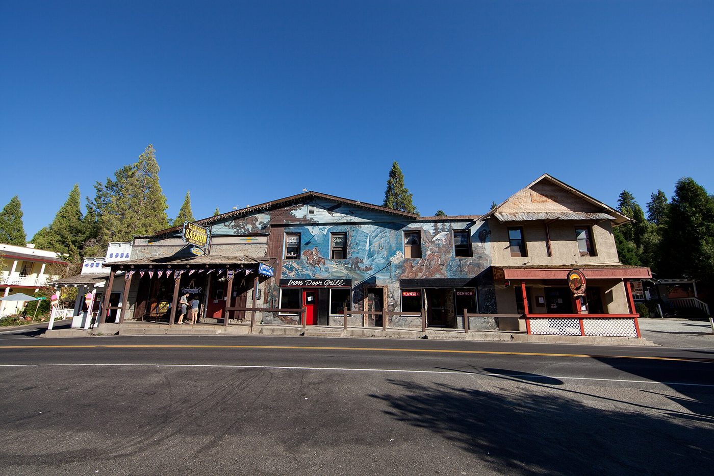
Mile 155 · right on CA-120 · 45 minutes to 1 hour
Groveland is the little town that feels like the last human deposit before Yosemite Valley: a wooden main street, a couple of hotels and restaurants, the Iron Door Saloon (one of California’s oldest continuously operating drinking establishments), and an easy place to pick up last-minute groceries, fuel, or a picnic. Big Oak Flat and Groveland are where you will slow down and begin to see granite outcrops and pine silhouettes; it’s also a sensible place to check tires, gas, and phone batteries before you climb the final miles into the park.
The road from Groveland to the park is a classic Sierra approach: it narrows a little, the grade picks up, and you get glimpses of the river canyon before the full valley opens. If you’re staying outside the park for the night, Groveland has lodging that fills in peak season; if you plan to camp inside Yosemite check the park’s latest road and campsite status and arrive with a reservation in hand.
Why we put it last: it’s the last genuine town before entrance stations and the last place with a relaxed main street to gather supplies. It sets the tone — the saloon, short hikes, and the scent of pine — and works as the final stretch to the valley entrance.
Arriving at Yosemite
There are several park gates and your choice matters by season and destination inside the park. From the Bay Area the Big Oak Flat Entrance on CA-120 is the most direct approach to Yosemite Valley and also gives you access to the Tioga Road when it’s open. CA-140 (Arch Rock / El Portal) from Merced and Mariposa follows the river and is less prone to winter closures; CA-41
Yosemite Valley itself is compact but busy — parking and shuttle logistics are easier if you arrive early in the day or later in the afternoon when crowds thin. If you want led hikes or guided tours, book ahead: shuttle reservations, guided walks, and some seasonal tours are limited; book Yosemite tours and shuttles can help with organized options, and self-guided audio for Yosemite Valley is a tidy way to have stories and context playing as you drive the valley roads.
How we would time it
Leave San Francisco around 7:00 a.m. to avoid the worst of Bay Area traffic and have time for the stops. Coffee in Livermore by 8:00, on the road by 8:40. Mid-morning stretch or a light lunch in Jamestown at about 11:30 if you detour there; otherwise roll through Oakdale and aim for Groveland by mid-afternoon. Arrive at the Big Oak Flat or Arch Rock gate in time to check in and get into the valley before late afternoon light (around 3:30–5:00 pm depending on season). If you want sunset views or an evening hike, plan to be in the park with a reserved campsite or a confirmed hotel inside or immediately outside the gate.
Booking the rest of it
If you’re flying into the Bay Area, pick up your rental car close to where you land or in San Francisco proper; comparing EconomyBookings and GetRentacar is a good place to start. One-way rentals down to Fresno or other regional airports are possible but often pricey, so many people plan a round trip to avoid extra fees. Lodging inside Yosemite and in the gateway towns — Groveland, Mariposa, El Portal and Wawona — books quickly for summer weekends and holidays; reserve early for July and August. If you want a guided day-hike, a shuttle to Glacier Point, or tickets for popular park programs, book those in advance as well; those options fill up and are often limited by season and capacity.
If you have an extra day: drive the Merced River canyon on CA-140 to see El Capitan and Bridalveil Fall from road pullouts, or time a morning for Glacier Point and the panoramic view of Half Dome, then come down into the valley for a short hike to Vernal Fall or a walk on the Valley Loop. If Tioga Road is open, a morning out at Tuolumne Meadows is a sublime counterpoint to the valley — higher, quieter, and with alpine lakes and short, stunning walks.
Final notes: check the park road status and any chain requirements before you leave, especially in shoulder seasons; gas and food are cheapest and easiest to find before Groveland; and remember that the park’s cell coverage is spotty — download maps, reservations and trail info in advance. With the right timing this is a day that moves quickly from urban morning to cathedral granite and waterfalls by afternoon: plan stops for comfort and a little curiosity, and the arrival will feel deserved.
The three stops on a map
Stops in driving order. Map data © OpenStreetMap contributors.
How far is San Francisco to Yosemite and how long does it take?
Roughly 190–195 miles and about 3 hr 50 min to 4 hr of driving without heavy traffic. Expect 4–5 hours with short stops and more if you hit Bay Area or foothill rush hours.
Which is the best road into Yosemite from San Francisco?
CA-120 (Big Oak Flat) is the most direct and commonly used from the Bay Area; CA-140 through Merced/Mariposa is the more sheltered river-canyon route and often preferred in winter; CA-41 comes up from Fresno to the south. Your destination in the park and the season should guide the choice.
Where should we fill the car and what about EV charging?
Fill up in the larger towns before you reach Groveland — Livermore, Oakdale and Groveland are the last reliable fuel stops. EV chargers are available in Livermore and some larger towns; charging options thin once you get into the foothills, so leave with a top-up if you can.
Is Tioga Road open year-round?
No. Tioga Road (the mountain pass portion of CA-120 east of the valley) is seasonal and typically opens in late spring or early summer and closes with the first significant snows. If you plan to use Tioga Road, check the park’s road status for exact opening dates.
Can you do Yosemite as a day trip from San Francisco?
Yes, but it’s a long day: expect 8–10 hours round trip with a few short stops in the foothills, and you’ll need to prioritize — scenic drives, a short valley walk, or one waterfall hike. An overnight stay gives you time to see more of the valley or to head up to Glacier Point or Tuolumne Meadows if the season allows.
Now let us do this for your drive
Every stop above is one we would take ourselves — but it is our day, not yours. Change the departure time, the driving limit, the dog in the back seat, the EV that needs a charger every 200 miles, and the right stops change with it. That is the whole thing we built: you tell us the trip, we name the three good stops, with the drive math already done.
Leaving from somewhere else? Change the start and see your stops right now — your first trip is free, no signup.
Seeing your stops is free. The full plan — clock times, weather, what is open when you arrive — is free for your first trip, then 99¢ for three trips or $2.99 a month. If you just want to browse, we have stop-by-stop pages for thousands of routes.
More road trip guides
- San Francisco to Lake Tahoe
- San Francisco to Los Angeles on Highway 1
- San Diego to Los Angeles
- Portland to Bend
- Phoenix to Grand Canyon
- New York to Washington, D.C.
- All road trip guides
We write one new drive a week — three real towns, the drive math, what we would skip. Leave an email and we will send them as they go up. No more than one a week, unsubscribe in a click.
Updated 2026-11-04. Some links on this page are affiliate links. If you book through one, we may earn a small commission at no extra cost to you. It never changes which stops we pick — no business on this page paid to be here.